Drawing Stationery Suppliers – Multifunctional Map Measuring Instrument Compass – OPTICAL INSTRUMENT
Drawing Stationery Suppliers – Multifunctional Map Measuring Instrument Compass – OPTICAL INSTRUMENT Detail:
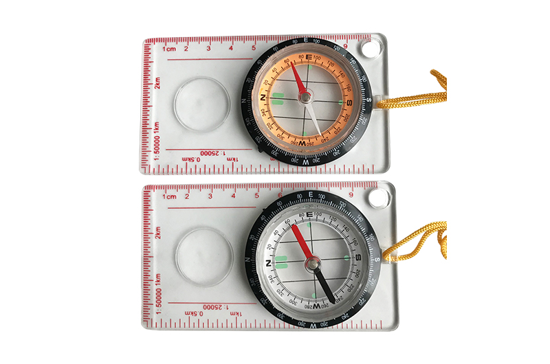
Product Informations
| Model: |
DC40-2 |
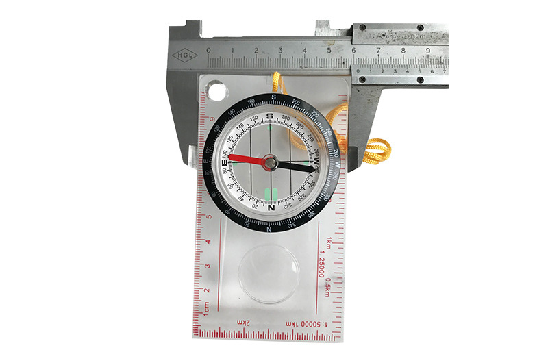
MG45-5H |
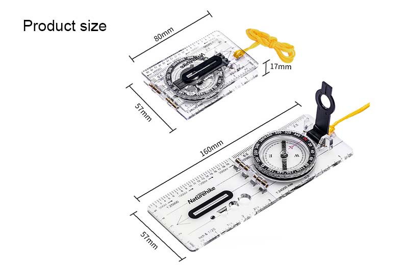
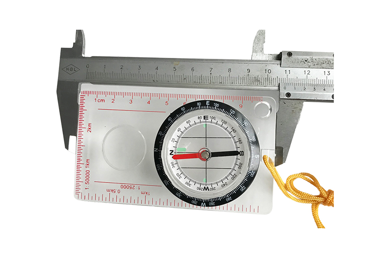
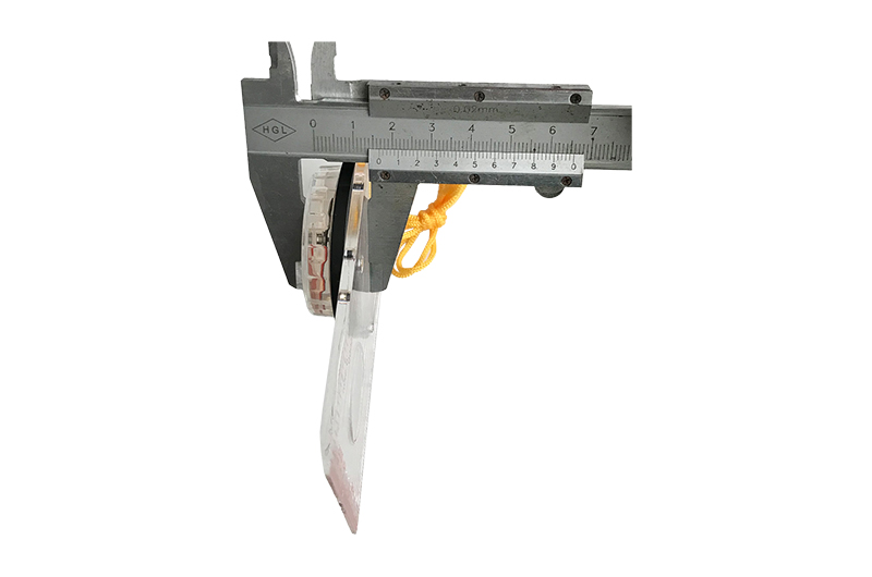
| product size | 45mmX11mm | 109 x 61 x17 mm |
| Material: | Acrylic,ABS | Acrylic |
| Pcs/ carton | 240pcs | 240PCS |
| Weight/carton: | 17kg | 15.5KG |
| Carton size: | 40X27.5X41.5CM | 50X45X33.5cm |
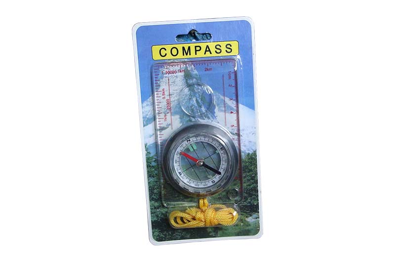
| Short Description: | Folding Outdoor Map Measuring Tools Compass With Scale For Hiking | Scale Acrylic Map Multifunction Measure Compass With Lanyar |
DC40-2 Features:
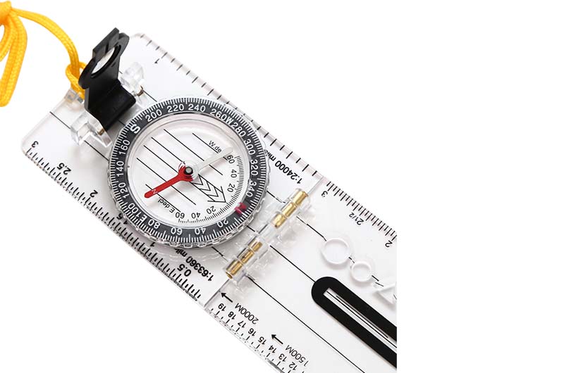
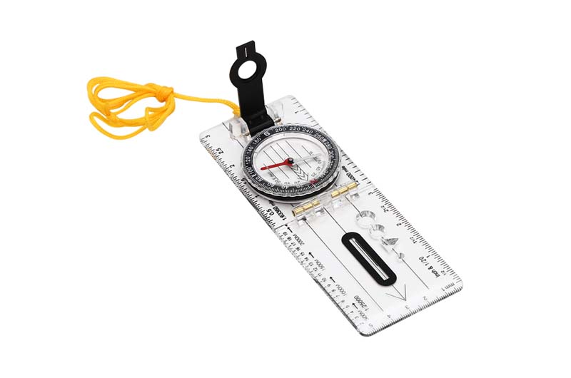
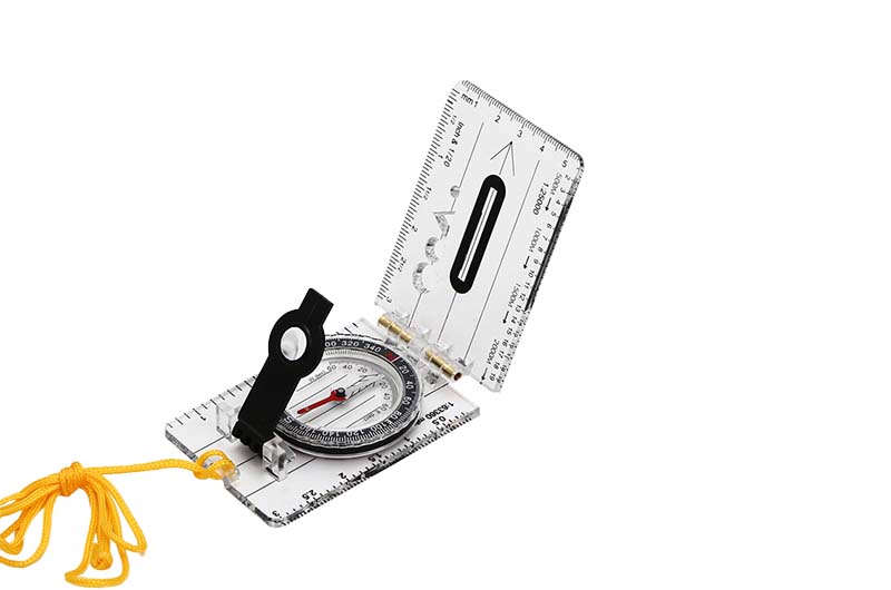
1. Foldable map needle compass with lifting rope.
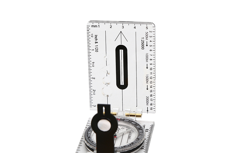
2. With Direction deflection Angle and scale in centimetre.
3. Easy To Carry and Broad use
4. Use climbing to the montain or hill.
5. The pocket size is convenience to carry. you can use it in everywhere and every time
6. Ideal for locating positions on a map or in the field
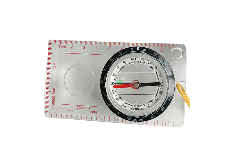
MC 45-5H Features:
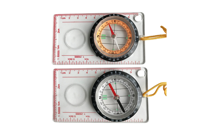
1. Acrylic ruler and ABS scale ring
2. Insert 44mm compass with liquid filled
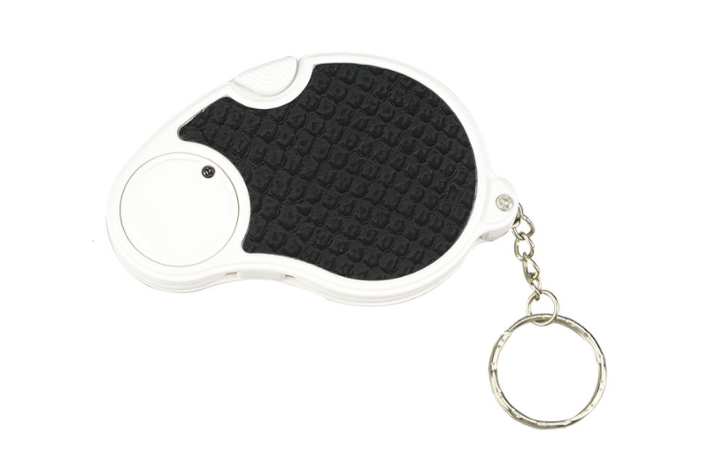
3. With magnifier and strap
4. Map scales: 1:50000km, 1:25000km, 10cm
Basic knowledge of compass:
1. Understand the basic structure of compass. Although the design of compass varies greatly, they all have something in common. All compasses have magnetic needles pointing to the earth’s magnetic field. The most basic field compass is also called base compass. The basic components of this compass are as follows:
The base plate refers to the plastic chassis inlaid with compass pointer.
The pointing arrow refers to the arrow indicating the direction on the base plate, which is usually opposite to the direction of the compass holder.
Compass cover refers to the plastic round shell containing the compass and magnetic needle.
The dial refers to the scale that marks the direction of 360 degrees around the compass cover and can be rotated by hand.
Magnetic needle refers to the pointer rotating in the compass cover.
The directional arrow refers to the non-magnetic pointer in the compass cover.
The directional line refers to the line parallel to the navigation arrow in the compass cover.
2. Holding the compass in the right way. Place the compass flat on your palm and your palm on your chest. This is the standard way to hold a compass when outdoors. If you want to refer to the map at the same time, put the compass flat on the map so that the result will be more accurate.
3. Figure out the direction you’re facing. If you want to navigate correctly, you must first clarify the direction in front of you. Check the magnetic needle on the compass. The magnetic needle will not deflect back and forth only when pointing north.Rotate the dial until the directional arrow and the magnetic needle are in line, and then point them to the North together, so that the directional arrow will tell you the direction in front of you. If the directional arrow is between the north and the East, you are facing the northeast.Find the point where the pointing arrow meets the dial. If you want more accurate results, you can carefully check the scale on the compass. If the pointing arrow points to 23 on the dial, the direction in front of you is 23 degrees north by East.
4. Understand the difference between the north in the sense of direction and the north of the magnetic needle. Although the two concepts of “North” are easy to confuse, I believe you can master this basic knowledge soon. If you want to use the compass correctly, you must understand this concept. The true north or map north refers to the point where all meridians on the map converge at the North Pole. All maps are the same. The north is above the map. However, due to the small difference of magnetic field, the direction pointed by the compass may not be the real North, but the so-called magnetic needle north.
The difference between the north of the magnetic needle is caused by the deviation of the magnetic field, which is about 11 degrees away from the earth’s central axis. In this way, there will be a 20 degree difference between the real north of some places and the north of the magnetic needle. To accurately read the direction of the compass, the influence of magnetic field deviation needs to be taken into account. The size of the impact varies with the location.
Sometimes the difference is thousands of miles. The on the compass once seems insignificant, but after walking a kilometer or two, the difference will appear. You can imagine what would happen if you were more than ten or twenty kilometers away. Therefore, the magnetic field deviation must be taken into account when reading.
5. Learn to correct deviation. Deviation refers to the difference between the true north on the map and the North pointed by the compass caused by the magnetic field. You can correct the compass to make the direction result more accurate. The method is to increase or decrease the number appropriately according to the different measurement methods (whether with the help of map or just relying on Compass) and different positions (in the east or west area). Find out where the zero deviation position of your country is, and then calculate how much you need to add or subtract according to your specific position. For example, if you use the compass in the west side area, you need to add the appropriate degree to the reading to find the correct orientation on the map. If you are in the easterly zone, subtract the degrees appropriately.
To learn more, please kindly contact us, thank you.
Product detail pictures:
Related Product Guide:
We retain improving upon and perfecting our items and repair. At the same time, we perform actively to do research and progress for Drawing Stationery Suppliers – Multifunctional Map Measuring Instrument Compass – OPTICAL INSTRUMENT, The product will supply to all over the world, such as: Malta, USA, Italy, With high quality, reasonable price, on-time delivery and customized & customized services to help customers achieve their goals successfully, our company has got praise in both domestic and foreign markets. Buyers are welcome to contact us.
The customer service staff is very patient and has a positive and progressive attitude to our interest, so that we can have a comprehensive understanding of the product and finally we reached an agreement, thanks!


